Monday
July 3, 2000
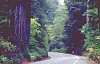
John Muir
Trail
Opens High Sierra To Hiking
By Polly Matthews
TOLLHOUSE -- Completion of the mapping
phase of the newly created John Muir Trail across the Sierra Nevada Range
was completed in 1912. Officials at the Sierra National Forest told reporters
that the entire amount spent on the just mapping the Trail was $5500 and came
from the Tract budget.
Exploring and mapping of the High Sierra was done in
the late 1800s by men like Theodore Solomons, Bolton Brown and Joseph LeConte.
With funds from the California state legislature, the Park Service and Forest
Service began construction of the trail in 1908. The completion of the trail in
1916 was the result of the needs and dreams of many people.
The John Muir Trail officially begins at Happy Isles in
Yosemite and ends on the summit of Mt. Whitney. Obtaining a permit to begin your
trip at Mt. Whitney is very difficult, as many people wish to climb Mr. Whitney
and you must compete with them for permits. There are many other possible entry
trails along the way that will shorten the trip and provide easy access. On the
Inyo National Forest several trails have their own destination quota for accessing
Mt. Whitney.
The most popular time to travel the John Muir Trail is
July through October. Snow may be present on high ridges and passes in early July.
Most of the trail is at elevations above 7000 ft. and in some places over 13,000
ft. Summer days are usually warm, but freezing temperatures may occur at any time.
Snow usually covers the trail in November.
A wilderness permit is required for any overnight stay
in Wilderness or National. Park backcountry areas. During the summer season, quotas
are in effect on popular trails to minimize backcountry impacts and provide a
quality wilderness experience for all visitors. Plan your trip early. Contact
the Ranger Station nearest your entry point for further information on obtaining
your wilderness permit.
Wood fires are prohibited in some areas due to fire danger
and the scarcity of dead and down wood. In areas where fires are allowed, dead
and down wood may be scarce or too wet to burn. Never cut down standing trees
or branches off of standing trees. Please use existing campfire rings and make
small fires to conserve available firewood.
Extinguish fires with water, stirring until cold, never
pour dirt on your fire as this rapidly fills the campfire ring. Campstoves are
strongly recommended.